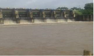
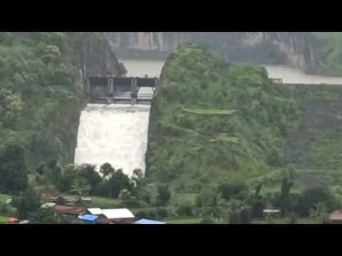
1.Yedgaon Dam :
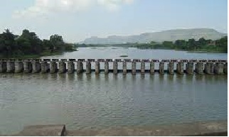
It is an earthfill and gravity dam on Kukadi river near Junnar, Pune district in the state of Maharashtra in India. The site at Yedgaon is situated upstream of both the Pune-Nasik road as well as the Pimpalwandi village. It will, therefore affect neither the road nor the township. But the conditions of foundations at this site are not as favorable as at Kandali Village. Rock is exposed on the right bank of the river. It is, however, deep seated on the left flank, and is available in the river bed at a reasonable depth. Rough cost studies indicate that considering the submergence, cost at Kandali are still higher than the costlier foundation at Yedgaon, even after considering the cost of additional 7Km. length of canal in favor of Kandali, Yedgaon is thus chosen for this project. The site is situated 2.5km. downstream of the Yedgaon village Latitude 190 -10’-30’’ North and Longitude 740 -1’-30’’ East, and is approachable by a cart track, taking off from the Pune-Nasik road in mile No. 49/6 and about 5km. away from the National Highway.18 Construction of Yedgaon dam has been completed in all respects with full storage capacity up to June, 1977, and the layout described below is one finally adopted for construction after considering the various alternative layouts in the past. The principal command lies on the left flank and the canal taking off from Yedgaon weir is the Kukadi Left Bank Canal. However, since there is deep over burden on the Left Bank and rock is deep seated, the outlet structure is located on the right bank river at Ch. 2804m. At this location the earth dam has been terminated by divide wall on left side of outlet is provided with a non-overflow section as the same was found to be economical and convenient.19 On first lake fill in monsoon of 1977, it is observed that some area downstream of dam goy water logged. Therefore, in 1979, numbers of relief walls were constructed as remedial measure. Now water logged area is considerably reclaimed.
REFERENCE:
https://shodhganga.inflibnet.ac.in/bitstream/10603/13221/13/13_%20chapter%20iii%20kukadi%20canal%20irrigation%20project.pdf Dated 10.08.2020
1.1 Specifications
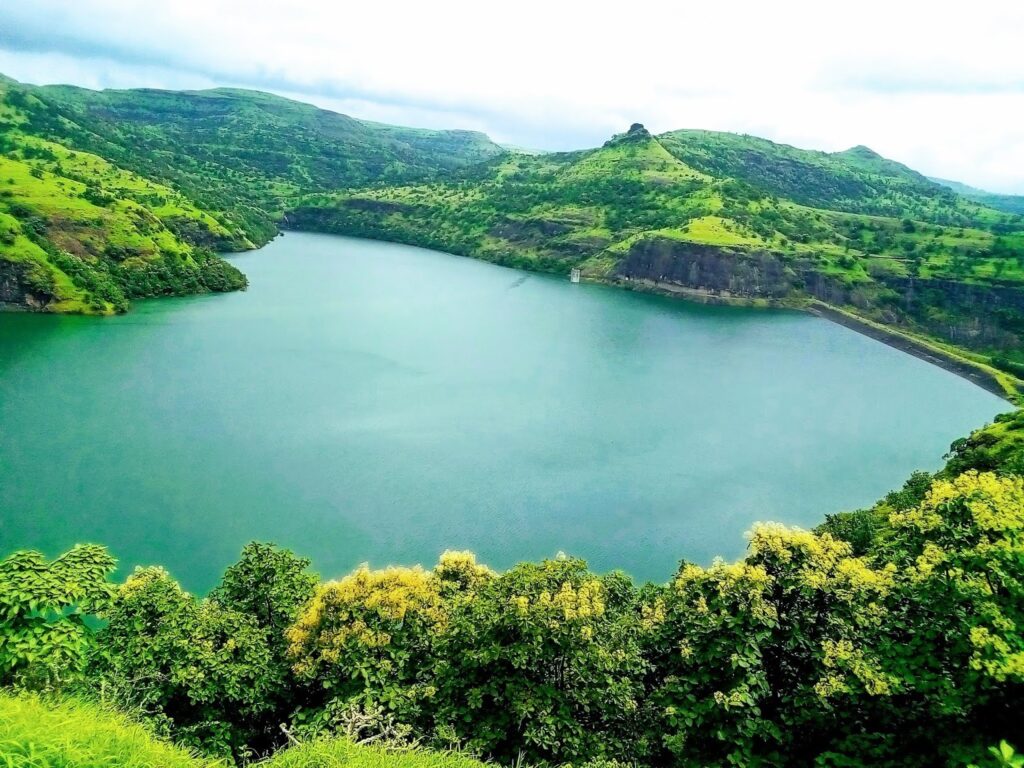
The height of the dam above its lowest foundation is 29.74 m (97.6 ft) while the length is 4,511 m (14,800 ft). The volume content is 1,004 km3 (241 cu mi) and gross storage capacity is 93,430.00 km3 (22,415.05 cu mi).[1] The dam is located in the Ghod basin and is part of the Kukadi project, which constructed five dams in the region. Other dams included in this project are Wadaj Dam, Manikdoh Dam, Dimbhe Dam and Pimpalgaon Joge Dam.[2]
1.2 Purpose
- Irrigation
- Yedgoan is one of the top producer of tomatoes in Junnar.
- Yedgon dam provide the strong water resource to the agricultural farming in the yedgaon village.
1.3 Details of Dam
| Name of Dam | Yedgaon |
| Year Completed | 1977 |
| River | Kukadi |
| Location | Pune, Junnar |
| Type | Gravity EarthFill |
| Height (m) | 29.74 |
| Length (m) | 4511 |
| Volume content (103m3) | 1004 |
| Gross Storage Capacity (103m3) | 93430 |
| Reservoir Area (103m2) | 1700 |
| Effective Storage Capacity (103m3) | 79270 |
| Purpose | Irrigation |
| Designed Spillway Capacity (m3/s) | 3844 |
Reference: https://en.wikipedia.org/wiki/List_of_dams_and_reservoirs_in_India#Maharashtra dated 11.08.2020
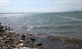
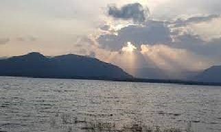
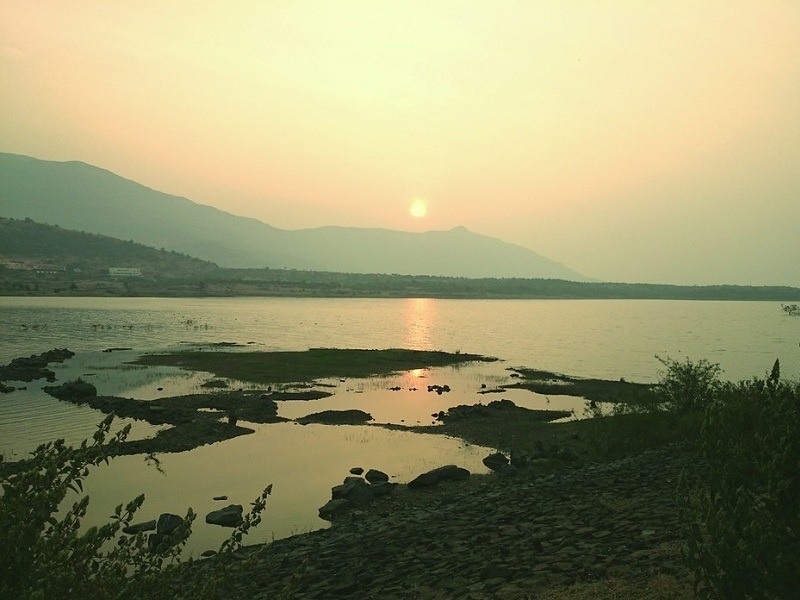
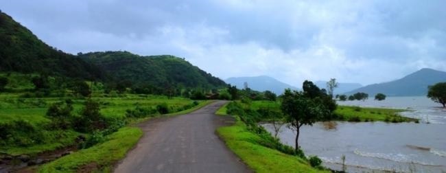
1.4 Photographs of Dam
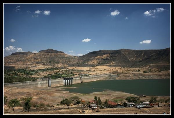
2 Maniikkdooh: Manikdoh Dam
This is a gravity dam on Kukadi River near Junnar, Pune district in state of Maharashtra in India. The river Kukadi flows between two hill ranges which are off shoots of Western Ghats, going in an eastern direction and forming the dividing ranges between the Ar and the Kukadi on side and the Kukadi and the Meena on the other. These off shoots have a few spurs approaching close to the banks of the river Kukadi at a few places between Thakarwadi and Padli villages. A few alternative dam sites were therefore investigated in this reach and they are described in detail in the earlier project report. In the administratively approved project report of 1966, a site near village Manikdoh had been recommended for this project and a composite am with masonry section in the main gorge and earth embankment on the both the flanks was proposed.20 The dam site is located at 190 -14’ north Latitude and 730 -49’ East Longitude. The site is approachable by Junner-Ghatghar road and is about 3km. from Junner. The dam on the river Kukadi at Manikdoh (i.e. Thakarwadi) envisages a gross storage of 308Mcum (10.88 TMC). Initially it is proposed to let out the water in to the river through six river sluices each of 1.2M. ͯ 1.8M provided in the spillway portion. This water was to be picked up at Yedgaon dam, already existing on the downstream for releases in the main Kukadi Left Bank Canal.21 During the course of construction, the people from Junner Tahsil demanded irrigation water from this storage at Manikdoh. Considering their demand, a small Left Bank Canal having 1.52Cumecs capacity at head is proposed, for a length of 23.5Kms. Due to this proposal out of the six river sluices originally proposed in the gorge, two are shifted near the outlet location at Ch. 270mtr in addition to the one for Manikdoh Left Bank Canal. Thus now there are four river sluices in the four piers in the spillway portion and three outlets of the same size at Ch. 270M at the starting of Manikdoh Left Bank Canal. The construction of the main dam is practically completed in June 1984.22 3.2.4c Dam at Wadaj on the Meena River
REFERENCE: https://shodhganga.inflibnet.ac.in/bitstream/10603/13221/13/13_%20chapter%20iii%20kukadi%20canal%20irrigation%20project.pdf Dated 10.08.2020
2.1 Specifications
The height of the dam above lowest foundation is 51.8 m (170 ft) while the length is 930 m (3,050 ft). The volume content is 596 km3 (143 cu mi) and gross storage capacity is 308,060.00 km3 (73,907.52 cu mi).[1] The dam is located in the Ghod basin and is part of the Kukadi project, which constructed five dams in the region. Other dams included in this project are Yedgaon Dam, Pimpalgaon Joge Dam, Dimbhe Dam and Wadaj Dam. A 6 MW power house is also built at the foot of this dam.[2]
2.2 Purpose
- Irrigation
- Hydroelectricity
2.3 Detailed of Dam
| Name of Dam | Manikdoh |
| Year Completed | 1984 |
| River | KUKADI |
| Location | Pune, Junnar |
| Type | Gravity EarthFill |
| Height (m) | 51.8 |
| Length (m) | 930 |
| Volume content (103m3) | 596 |
| Gross Storage Capacity (103m3) | 308060 |
| Reservoir Area (103m2) | 18434 |
| Effective Storage Capacity (103m3) | 283070 |
| Purpose | Irrigation,Hydro electricity |
| Designed Spillway Capacity (m3/s) | 1439 |
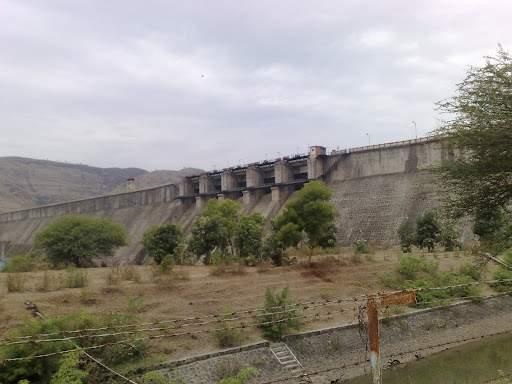
2.4 Photographs of Dam
Reference: https://en.wikipedia.org/wiki/List_of_dams_and_reservoirs_in_India#Maharashtra dated 11.08.2020
3 Wadaj Dam
Wadaj Dam, is an earthfill and gravity dam on Meena river near Junnar, Pune district in the state of Maharashtra in India. The river Meena is a left bank tributary of the Ghod and joins it near the village Shingve, situated about 16Kms. east of the village Manchar on Pune-Nasik road. The river rises on the eastern slopes of the western ghat at an altitude of about 1067M. Above M.S.L. it flows down the steep slopes of the hills and then runs through the valley defined by two parallel of shoots of the Sahyadris along the two banks of the river. The river valley opens in to a wide valley near Nirgudsar village; from the downstream of Wadaj village the valley becomes so wide that a storage site, which is both feasible and economical, is hardly possible. Any site downstream of Wadaj village entails heavy submergence of valuable and cultivated land.23 The Wadaj dam is located on River Meena near village Wadaj in Junner Tahsil of Pune district. The geodetic location of the dam site is 190 -8’ North latitude and 730 -54’ East Longitudes. According to the approved revised project report of Kukadi Project, the water from Wadaj dam was to be let out in to Meena River and picked up downstream at Basti pick-up weir from which a canal was to take off and was to be connected to Dimbhe Left Bank Canal. After reviewing the above proposal and studying necessary alternatives in the year 1977, it was found, that it would be more economical to take a direct canal from Wadaj storage instead of Ex-Basti pick-up weir. Moreover, there was similar demand of villagers for taking direct canal from Wadaj and provide irrigation to the lands at higher level. The construction of the main dam is practically completed in June 1983. The total storage capacity of tis storage is 35.94Mcum (1.27 TMC).24
REFERENCE: https://shodhganga.inflibnet.ac.in/bitstream/10603/13221/13/13_%20chapter%20iii%20kukadi%20canal%20irrigation%20project.pdf Dated 10.08.2020
3.1 Specifications
The height of the dam above its lowest foundation is 30.7 m (101 ft) while the length is 1,875 m (6,152 ft). The volume content is 1,009 km3 (242 cu mi) and gross storage capacity is 36,000.00 km3 (8,636.86 cu mi).[1] The dam is located in the Ghod basin and is part of the Kukadi project, which constructed five dams in the region. Other dams included in this project are Yedgaon Dam, Manikdoh Dam, Dimbhe Dam and Pimpalgaon Joge Dam.[2]
3.2 Purpose
- Irrigation
3.3 Details of Dam
| Name of Dam | Wadaj |
| Year Completed | 1983 |
| River | Meena |
| Location | Pune, Junnar |
| Type | Gravity Earth Fill |
| Height (m) | 30.7 |
| Length (m) | 1875 |
| Volume content (103m3) | 1009 |
| Gross Storage Capacity (103m3) | 36000 |
| Reservoir Area (103m2) | 467 |
| Effective Storage Capacity (103m3) | 33200 |
| Purpose | Irrigation |
| Designed Spillway Capacity (m3/s) | 1426 |
3.4 Photographs of Dam
Reference : https://en.wikipedia.org/wiki/List_of_dams_and_reservoirs_in_India#Maharashtra dated 11.08.2020
4 Pimpalgaon Joga
Pimpalgaon Joge Dam, is an earthfill dam on Ar Pushpavati river, a tributary of Kukadi River near Junnar, Pune district in the state of Maharashtra in India. The storage on Ar River near Pimpalgaonjoge was mainly intended to feed the Yedgaon dam and to a certain extent firm up the irrigation on the existing Bandhara at netwad on the Pushpawati River. Since 1976 there was increasing demands for irrigating additional areas by starting new canals and extending the present canals. A note based on water requirement by pan evaporation method was submitted to Government by working out the water requirement for 8 monthly cropping patterns to bring an additional area of 36300 hectares under irrigation. Out of this area, Pimpalgaon joge was recommended to have 55 km left bank canal to irrigate about 11500, hectares.27 The location site lies about 1.6 km. upstream of village Pimpalgaonjoge and is accessible from right flank by an un-metaled road leading to Junner, an important Tahsil town and is about 19 km. away from it. Also it can be approached by Ane-Malsej state highway; the dam line is just near this road and is about 25 km. away from Alephata towards Bombay. The geodetic location of the dam is as 190 -18’-45’’ North latitude and 730 -52’-30’’ East Longitudes. The Earthen Dam of Pimpalgaon joge, catchment area is 97 sq. miles with a corresponding Ingles discharge of 1145Cumecs (40.470 Cusecs). The total storage of this dam is 217.915M.cum (7.695 TMC). The dam construction was completed in the year 2000.
Reference : https://shodhganga.inflibnet.ac.in/bitstream/10603/13221/13/13_%20chapter%20iii%20kukadi%20canal%20irrigation%20project.pdf Dated 10.08.2020
4.1 Specifications
1The height of the dam above lowest foundation is 28.6 m (94 ft) while the length is 1,560 m (5,120 ft). The volume content is 2,010 km3 (480 cu mi) and gross storage capacity is 235,520.00 km3 (56,504.25 cu mi).[1] The dam is located in the Ghod basin and is part of the Kukadi project, which constructed five dams in the region. Other dams included in this project are Yedgaon Dam, Manikdoh Dam, Dimbhe Dam and Wadaj Dam.[2] As of 2010, the annual average rainfall in the catchment area of this dam was 900 mm.[3]
4.2 Purpose
- Irrigation
- The dam provides water to areas of Otur, Junnar, Narayangaon, Alephata and Parner, which are basically grape harvesting areas.[3]
4.3 Details of Dam
| Name of Dam | Pimpalgaon Joge |
| Year Completed | 1999 |
| River | AR |
| Location | Pune, Junnar |
| Type | Gravity Earth Fill |
| Height (m) | 28.6 |
| Length (m) | 1560 |
| Volume content (103m3) | 2010 |
| Gross Storage Capacity (103m3) | 235520 |
| Reservoir Area (103m2) | 263000 |
| Effective Storage Capacity (103m3) | 110240 |
| Purpose | Irrigation |
| Designed Spillway Capacity (m3/s) | 1943.7 |
4.4 Photographs of Dam
Reference: https://en.wikipedia.org/wiki/List_of_dams_and_reservoirs_in_India#Maharashtra dated 11.08.2020
5. Chilewadi Dam
Chilewadi dam, is an earthfill dam on Mandvi river near Junnar, Pune district in the state of Maharashtra in India.
5.1 Specifications
The height of the dam above lowest foundation is 62.56 m (205.2 ft) while the length is 440 m (1,440 ft). The volume content is 36.23 km3 (8.69 cu mi) and gross storage capacity is 27,170.00 km3 (6,518.43 cu mi).[2]
5.2 Purpose
- Irrigation
5.3 Photographs of Dam
| Name | Chilewadi |
| Year Completed | 2000 |
| River | Mandvi |
| Location | Pune, Junnar |
| Type | Gravity Earth Fill |
| Height (m) | 62.56 |
| Length (m) | 440 |
| Volume content (103m3) | 36.23 |
| Gross Storage Capacity (103m3) | 27170 |
| Reservoir Area (103m2) | 67410 |
| Effective Storage Capacity (103m3) | 24610 |
| Purpose | Irrigation |
| Designed Spillway Capacity (m3/s) | 1680 |
5.4 Photographs of Dam
Reference : https://en.wikipedia.org/wiki/List_of_dams_and_reservoirs_in_India#Maharashtra dated 11.08.2020